Canada 2026

Day 14 August 6, 2026 Slave Lake Alberta to Dorintosh Saskatchewan 307.0 miles

Had a big buffet breakfast included with our room. Rained very hard last night so the parking lot has lots of puddles and wet spots.

We were just out of town when we saw a buck very close to the road. Luckily he took off running in the opposite direction or we would have experienced a show stopper.

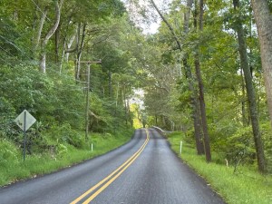
Small hills

Much of the road is very rough again. Lots of potholes in various sizes. Water drainage and weather conditions obviously contribute to the condition. Still lots of big trucks and they do go fast. The cars go faster. We haven’t seen many police officers writing tickets.

When we made our morning gas stop we noticed the grocery store across the street so we stopped in. The store is really nice with some good buys that we took advantage of. Half the store is clothing and household goods. Everyone brings their own bags.

Clouds over the prairie

We ate lunch at a small wide spot in the road. We have not seen any rest areas for quite some time.. Every time a truck passed the car rocked.

We were surprised to turn down a gravel road for the last 25 miles of our journey. I didn’t think gravel roads even showed on the maps. Oh well for a gravel road it was very good. In fact better than some of the paved roads.

Some of the black are angus cattle

The town is very small so finding the motel was not too difficult even though we used Google to do so. The door was locked so we went to the bar and hotel. They don’t do rooms any more but they knew the owner of the motel. They do have a room so we returned.

Rob heard of some interesting places to go visit that are not too far from here. We will see about that for tomorrow.

Field of hay bales

The trailer breakaway switch cable caught on something today. Not a big deal. However, we will need to get clever on how to reattach it in the morning. Sounds lke a good theme for a dream tonight.

Canada 2026

Day 13 August 5, 2026 Fort Vermilion Alberta to Slave Lake Alberta 260.8 miles

We made it through the night at the campsite with very little disturbance. A few kids rode a four wheeler through the area a few times but didn’t cause any problems. The only critter we saw was a small squirrel.

Overnight the starter on the car locked up. We put the car in gear and rocked it a little bit and the problem was resolved.

We drove back to the gas station and filled up. Another customer told us that the next gas was about 170 miles away. Good thing we have extra gas. Hopefully no wind.

Seems to be a combination of smoke and clouds. So far no wind or rain. The temperature is also warmer.

More rolling hills and forest today. Very few houses of any kind. Quite a few RVs. Also several horse trailers so there must be rodeos in the area. We have seen a few signs pointing to rodeo grounds.

Baled hay covered with tarps

Red Earth finally came into view. They have a gas station with a grocery store, sporting goods store, chicken fast food and liquor store. We remember that a few years ago we bought two fly swatters here. Bought Mary Brown’s chicken for lunch.

More of the road in the distance

The highway in front and for at least 10 miles is going to be resurfaced. Now it is grooved asphalt which is terrible to drive on. The posted speed limit is about 30 mph but everyone is going much faster. Well, we did not speed.

More winding road

When that came to an end the road got really very rough with potholes everywhere. You could not avoid them all. Road maintenance is not a high priority in this area. We were glad to see the town of Slave Lake come into view. We had a little trouble finding the hotels but we finally found three rather close together. The one we chose has a guest laundry which was really good. Saved going out again.

Canada 2026

Day 12 August 4, 2026 New Providence Northwest Territories to Fort Vermilion Alberta 316.2 miles

This is another day of backtracking. Therefore no new sites to see. We followed the MacKenzie River for several miles. It’s a big River comparable to the Mississippi River. We didn’t see any boats or barges however.

We hadn’t gone far when a light rain began to fall. It stayed with us most of the day. Heavier in some areas. No use taking pictures because they would all have polka dots. Wet polka dots.

When we got to the Hay River the wind really picked up. Might be a similar thing to the Columbia River gorge. The river does flow through a gorge in this area. The wind does seem to really affect our gas mileage. It drops two to three miles per gallon.

Another field

We fueled in High Level just to be sure. A guy there said he had seen us a few days ago but neglected to get a picture. He took one now. Another guy had a picture of when we were here a few years ago. We are helping to make memories.

Grain field

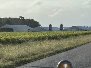
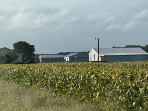
Once we crossed the border into Alberta the forested land decreased and the farm land increased. Back were the grain and canola fields.

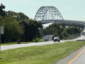
Bridge construction

The GPS was telling us the hotel was 49 miles away. We stopped and some of the locals came over. They told us where the hotel was located. We found it and Rob went in to check. He came back out and said they claim to be booked full. Rob says the trailer looked much better than any of the rooms possibly could. We had the address of a campground and headed there. It is located about six miles out of town. The campground seems empty for where we can see. We pulled into the first site since it is a drive through and set up camp. We ate dinner at the picnic table and then got back in the car before the rain started.

Peace River

The car is running fine. The refrigerator that stopped working a few days ago is trying to freeze everything. The refer did not get the memo about living a life in moderation.

Campsite
Trees at the campsite

Canada 2026

Day 11 August 3, 2026 Yellowknife Northwest Territories to New Providence Northwest Territories 163miles

The wind this morning seems much calmer than yesterday. Now it is only a slight breeze. The skies are blue with very few if any clouds.

The woodie is blocked in by vehicles on both ends, we did a parallel park as we were told rather than the drive in kind. Sometimes the trailer is too difficult to maneuver in reverse. Rob asked the desk clerk to find one of the drivers and ask them to move their car. A large group of young adults are packing up to leave. Turns out the vehicles belong to them. They moved one and we were able to get out. They have some kind of a big trailer somewhere because one of their vehicles is a small semi cab.We think that the were one of the competitors in a BBQ cookoff.

Wood bison

Wow we finally saw a bison. He was walking parallel to the road but in the middle of the mowed area. We didn’t seem to bother him. When we came along this road yesterday we didn’t see any bison. The area is near the bison reserve so some of them drift over.

A bit later a BBQ food truck passed us along with another trailer and several cars. It was the same group from the hotel. Must have been some event in Yellowknife.

Long road ahead

Two different men were cutting some of the fire killed trees and loading them. Most likely firewood for this winter. Certainly seems to be a lot of it. Perhaps most people don’t have wood stoves. We have been told that many people use propane for heating and cooking.

Then we saw a second bison. He was just standing there. No cares in the world.

Bridge construction

The air is getting smokey again. Must be forest fires somewhere. They don’t seem to be close so that is a good thing.

More food trucks passed us. Definitely something had been going on.

One of the couples we had seen a couple of days ago stopped when they saw us. They were just as impressed with Yellowknife as we were.

Rocks near Yellowknife

We ran out of fuel again but only had 11 more miles to go. Sure glad we brought along extra fuel. The gas station is out of town about 3 miles. We went to town and found a hotel for the night. It is on the river which is nice. We even have a river view room.

Two police officers stopped to check out the car. They were Canadian so they were very friendly and helpful like everyone we have met up here. They told us to contact them directly if we needed anything. That offer would not happen in the States.

Canada 2026

Day 10 August 2, 2026 Hay River Northwest Territories to Yellowknife Northwest Territories 302 miles

The day is mostly sunny but with a strong wind. We had trouble deciding whether to go further north to Yellowknife or go back south the High Level or Manning. Our host was pushing toward Yellowknife because he said the terrain was different and really pretty. It is also the provincial capital.

Some of burned forest

In the end we decided to go to Yellowknife as the likelihood of getting here again is slim. Well the wind all day was terrible and the road was like a washboard. Keeping the car in the center of the lane was lots of work.

Oil stop with more burned forest

Still miles and miles of burned forest. This must have been a huge fire. We gassed in Fort Providence because that is the only gas between Hay River and Yellowknife. We know we will run out somewhere along the way. We have only gotten about 14 miles to the gallon since we have had these strong headwinds.

Bridge across MacKenzie River

We stopped for a police officer who was escorting a wide load. He suggested we stay off the road until it passed. Fortunately that wasn’t very long. They were moving the equivalent of a double wide manufactured home. They were driving faster than either of us would have driven.

Crossing MacKenzie River

Then we came to the big bridge across the MacKenzie River. This river drains 1/3 of Canada into the Arctic Ocean. That means the river flows north which just doesn’t seem right. The Hay River also flows north into the Great Slave Lake which is the fifth largest fresh water lake in North America.

End of bridge and end of burned forest

We ate lunch at a pull out along the road. Rob left the back of the trailer open as normal. A crow managed to get in there and begin to open one of the beef sticks and take an empty food container to the ground. We now have a new normal. The pantry will be closed to crows.

Some of rock

A very short glimpse of the Great Slave Lake came into view. We really could not see the full size. It is about 300 miles long.

More rock

Off on a dirt road we saw the wide load from this morning. Not sure how much further it needs to go.

More rock yet

We came to another older bridge. They are building a new bridge but haven’t gotten very far yet.

We ran out of gas with 27 miles to go. Rob put in one of the Jerry cans and hopes the gas station is on the edge of town. The landscape has changed slightly. There are now rock formations scattered among the trees. Our host thought these were very interesting. Didn’t seem all that unusual to us.

We were coming into town but no gas stations. In fact we were right down town. We asked Gas Buddy for directions. They were back on a road we had seen coming into town. We headed that way and took the first one we found. They only had regular gas but at least it was gas. The hotels listed in town all seem to be downtown. So we started driving and saw a Super 8. That had to be one of most difficult to get into. The road entrance was so poor that it had to be hurting their business. Then about six Natives kept taking pictures and asking questions. They were profiled as a group looking for trouble to get in to. Some others at the gas station had asked for money. These were the first beggars we have experienced on the trip. So far we are not impressed with this town.

Canada 2026

Day 9 August 1, 2026 High Level Alberta to Hay River Northwest Territories 232 miles

Mostly cloudy today. Before we left a father with two young boys stopped to talk about the car. Both boys got to honk the horn. The father has an uncle who lives in Fruitland Idaho. He had even been there a few times. Small world again.

Not far out of town we did see a lone doe. She was standing in a field.

A large sign warned of possible bison on the road. We are near an area where they are protected. These are wood bison so they are a bit smaller and darker in color. We saw other warning signs but never any live bison.

Stopped along the road and added some oil. Nothing bad just time to add a little.

The wind has really picked up speed. That along with the permafrost dips in the road makes for an uncomfortable ride.

The woody at the 60th parallel Visitor’s Center

We stopped at the 60th parallel visitor’s center. Rob is trying to get us signed up for next year’s Model A Convention. Turns out you must print the form, fill it out and mail it with a check. No printer at the Visitor’s Center. They do however have several stuffed local animals. They also have pictures and write ups about the region. Definitely worth the stop. We said we hoped to stop at the Twin Falls Gorge Territorial Park. The host said the trails to the falls are closed due to the banks sliding away.

We did stop at the pullout by the falls. The trails were definitely barricaded so we didn’t try to go down.

Inside the Visitors Center

The forest for the rest of the way to Hay River had burned within the last couple of years. Lots of standing black trees and very short undergrowth.

We gassed up and then started looking for a place to stay. We didn’t see one right away, but we did take a short tour of the town. Coming back to town we stopped at the first hotel we found. They were fully booked but gave us names and numbers of other places in town. Seems they are having a big baseball tournament and some big native games that last for 3 days.

The view from our host’s back yard

While we were sitting there two men stopped to look at the car. Rob explained we were looking for a place to stay. The second man (Garry) said “Well come stay at my house.” He was a widower and said he had room. We followed him back to his house which sits right on the river. He has a wonderful location. On the way there he called his girlfriend (Davida) and told her to bring dinner. We had a fabulous dinner and great conversation. Turns out even the campgrounds were full. We could not have asked for a better place. We stayed up late talking and learning about Canadian history and the various area cultures.

Canada 2026

Day 8 July 31, 2026 Spirit River Alberta to High Level Alberta 247.0 miles

Another partly cloudy day. Not too much wind at least to start. Just as we got in the car to go a young man stopped to look at the car. Then he went to get his daughter out of the car. Guessing she is about three. She was too shy to tell us her name but she thought honking the horn was funny.

Not far out of Spirit River

We tried for gas but it seems a different system not the traditional brands. The next town is only a few miles away and Gas Buddy says they have some. So off we went. We followed the directions given by Gas Buddy but that fueling point no longer exists. A young lady was walking by with her baby in a stroller. She said to follow the road back to the highway and we would find three stations at the highway intersection. Sure enough right there where we were to turn were three large stations.

A little further and a river comes into view

The land here is quite flat with large fields of canola and grain. The canola fields are such a bright yellow and the grain is mostly a dark green. The contrast between the two crops side by side is stunning. Two bucks and one doe were in the fields on their way somewhere. They were larger than some deer. Glad they stayed in the field but nice for the short viewing.

More canola

We did drop down to a river and then climbed back up. The gorge went quite a ways. The land on either side however was mostly flat.

We ate lunch at a Subway. They mark the sandwiches that the ingredients were grown in Canada. That way they can support their own. Good idea we think. We talked to a nice couple while we waited in line. They had seen us on the road. They were going to a 50th wedding anniversary. They were just more friendly Canadians.

On the way out of town we spotted a moose. Unfortunately it was a life size statue. That may be the only one we see.

Moose statue

The trees have changed to mostly aspen. A very large forest fire went through here a few years ago based on the size of the new growth. Lots of standing dead trees also. The road was so long and straight it reminded us of Nebraska or Kansas. There are numerous small ponds and creeks. Most have cat tails or other water vegetation growing in them. No farms or any businesses for miles. We saw a few homes with a teepee in their backyards.

Just along the way

Then we came to High Level. The plan was to camp here but there are very few if any trees and the flys at the gas station were terrible. The local population must be largely Indian. They are very fascinated by the car. At the gas station was a locked box labeled sand bags. Must get some flooding here at times.

Remains from forest fire

Want a happy life? Have a happy wife. We bailed on camping tonight and got a motel room which just happens to have a kitchenette. The town has quite a few lodging options.

Aspen trees

By the way A&W restaurants out number all the other fast food options.